


Voting Districts not defined, Talbot County, Maryland
About
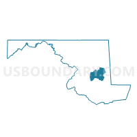
Outline

Summary
| Unique Area Identifier | 593170 |
| Name | Voting Districts not defined |
| County | Talbot County |
| State | Maryland |
| Area (square miles) | 192.51 |
| Land Area (square miles) | 0.00 |
| Water Area (square miles) | 192.50 |
| % of Land Area | 0.00 |
| % of Water Area | 100.00 |
| Latitude of the Internal Point | 38.76935030 |
| Longtitude of the Internal Point | -76.37180340 |
Maps


Graphs
Select a template below for downloading or customizing gragh for Voting Districts not defined, Talbot County, Maryland


Neighbors
Neighoring Voting District (by Name) Neighboring Voting District on the Map
- Anne Arundel Precinct 07-001, Anne Arundel County, MD
- Anne Arundel Precinct 07-002, Anne Arundel County, MD
- Anne Arundel Precinct 07-003, Anne Arundel County, MD
- Caroline Precinct 04-001, Caroline County, MD
- Dorchester Precinct 07-001, Dorchester County, MD
- Dorchester Precinct 07-003, Dorchester County, MD
- Dorchester Precinct 07-006, Dorchester County, MD
- Dorchester Precinct 08-001, Dorchester County, MD
- Queen Anne's Precinct 04-002, Queen Anne's County, MD
- Queen Anne's Precinct 04-006, Queen Anne's County, MD
- Queen Anne's Precinct 04-007, Queen Anne's County, MD
- Queen Anne's Precinct 05-001, Queen Anne's County, MD
- Queen Anne's Precinct 05-002, Queen Anne's County, MD
- Talbot Precinct 01-001, Talbot County, MD
- Talbot Precinct 01-005, Talbot County, MD
- Talbot Precinct 02-001, Talbot County, MD
- Talbot Precinct 02-002, Talbot County, MD
- Talbot Precinct 02-003, Talbot County, MD
- Talbot Precinct 03-001, Talbot County, MD
- Talbot Precinct 03-003, Talbot County, MD
- Talbot Precinct 04-001, Talbot County, MD
- Talbot Precinct 05-001, Talbot County, MD
- Talbot Precinct 05-002, Talbot County, MD
- Voting Districts not defined, Calvert County, MD
Top 10 Neighboring County Subdivision (by Population) Neighboring County Subdivision on the Map
- District 7, Anne Arundel County, MD (78,295)
- District 3, Sunderland, Calvert County, MD (29,757)
- District 1, Easton, Talbot County, MD (21,656)
- District 4, Kent Island, Queen Anne's County, MD (18,157)
- District 7, Cambridge, Dorchester County, MD (14,443)
- District 5, Queenstown, Queen Anne's County, MD (8,812)
- District 2, St. Michaels, Talbot County, MD (5,318)
- District 4, Chapel, Talbot County, MD (4,502)
- District 3, Trappe, Talbot County, MD (4,384)
- District 4, Preston, Caroline County, MD (4,044)
Top 10 Neighboring Place (by Population) Neighboring Place on the Map
- Cambridge city, MD (12,326)
- Algonquin CDP, MD (1,241)
- St. Michaels town, MD (1,029)
- Tilghman Island CDP, MD (784)
- Oxford town, MD (651)
Top 10 Neighboring Unified School District (by Population) Neighboring Unified School District on the Map
- Anne Arundel County Public Schools, MD (537,656)
- Calvert County Public Schools, MD (88,737)
- Queen Annes County Public Schools, MD (47,798)
- Talbot County Public Schools, MD (37,782)
- Caroline County Public Schools, MD (33,066)
- Dorchester County Public Schools, MD (32,618)
Top 10 Neighboring State Legislative District Lower Chamber (by Population) Neighboring State Legislative District Lower Chamber on the Map
- State Legislative Subdistrict 37B, MD (86,699)
- State House Districts not defined (Talbot County), MD (0)
- State House Districts not defined (Dorchester County), MD (0)
- State House Districts not defined (Queen Anne's County), MD (0)
- State House Districts not defined (Anne Arundel County), MD (0)
- State House Districts not defined (Calvert County), MD (0)
Top 10 Neighboring State Legislative District Upper Chamber (by Population) Neighboring State Legislative District Upper Chamber on the Map
- State Senate District 37, MD (129,289)
- State Senate Districts not defined (Calvert County), MD (0)
- State Senate Districts not defined (Anne Arundel County), MD (0)
- State Senate Districts not defined (Queen Anne's County), MD (0)
- State Senate Districts not defined (Dorchester County), MD (0)
- State Senate Districts not defined (Talbot County), MD (0)
Top 10 Neighboring 111th Congressional District (by Population) Neighboring 111th Congressional District on the Map
Top 10 Neighboring Census Tract (by Population) Neighboring Census Tract on the Map
- Census Tract 8106, Queen Anne's County, MD (4,910)
- Census Tract 9605.01, Talbot County, MD (4,752)
- Census Tract 9601, Talbot County, MD (4,495)
- Census Tract 9609, Talbot County, MD (4,294)
- Census Tract 9602.01, Talbot County, MD (4,104)
- Census Tract 9555, Caroline County, MD (4,044)
- Census Tract 9707.02, Dorchester County, MD (3,987)
- Census Tract 9605.02, Talbot County, MD (3,833)
- Census Tract 9607, Talbot County, MD (3,635)
- Census Tract 9704, Dorchester County, MD (3,305)
Top 10 Neighboring 5-Digit ZIP Code Tabulation Area (by Population) Neighboring 5-Digit ZIP Code Tabulation Area on the Map
- 21601, MD (23,597)
- 21613, MD (17,330)
- 21655, MD (5,009)
- 21638, MD (4,934)
- 21658, MD (3,862)
- 21663, MD (3,308)
- 21673, MD (3,136)
- 21654, MD (1,236)
- 21671, MD (756)
- 21662, MD (555)